

Murray Wood: The most important documents in your house probably aren't the ones you think of first
As Murray Wood explains, the most important pieces of paper in our lives are often buried in a drawer or a box in a clos...
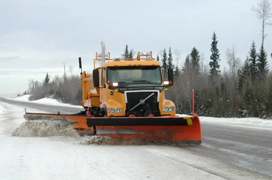
Saskatchewan is in for a week of increasingly harsh winter weather, with freezing rain, icy highways and an extended cold snap all in the forecast, according to Environment Canada.
Meteorologist Dave Carlson said a weather system will build up in the province on Monday, starting with light snow in the north and bringing a risk of freezing rain to central and southern regions later in the day. He said the setup is typical for December, but the timing and temperatures will likely make travel tricky.
Read more:
The heaviest freezing rain risk will stretch from Kindersley southeastward through Moose Jaw and Regina, Carlson said, continuing into the overnight hours.
He said the most significant impact could be felt early on Tuesday morning.
“It’s going to be really slippery,” the meteorologist said. “Even into the morning drive on Tuesday, we could be seeing some fairly slick conditions.”
The system is expected to move out of Saskatchewan by the end of the day on Tuesday, but the province won’t get much of a break. An Arctic air mass is expected to drop into the province immediately afterward, bringing temperatures far below what the province typically sees in early December.
Seasonal highs for this time of year are around -10 C across the southern half of the province. This week, many communities will see daytime highs between -15 C and -20 C, with overnight lows dipping to around -25 C.
“Temperatures are going to plunge to well below normal values… quite a bit colder than usual for this time of year,” Carlson said.
He said the cold will be persistent, settling into the province for several days and likely stretching toward the end of the week. While brief flurries are possible behind the system, Carlson said no significant snowfall is expected beyond Monday’s northern band.
The shift to colder weather marks a sharp turn after a mild fall that held on across much of Saskatchewan well into November. Carlson said that warm stretch kept snow at bay longer than usual, but the province is now making up for lost time.
“That switch just got flipped,” he said.
“We were well above normal, and now we’re in the deep freeze.”
Environment Canada advised drivers to monitor highway conditions closely on Monday and Tuesday, noting that slick roads, black ice and reduced visibility may all play a role in Tuesday’s commute.
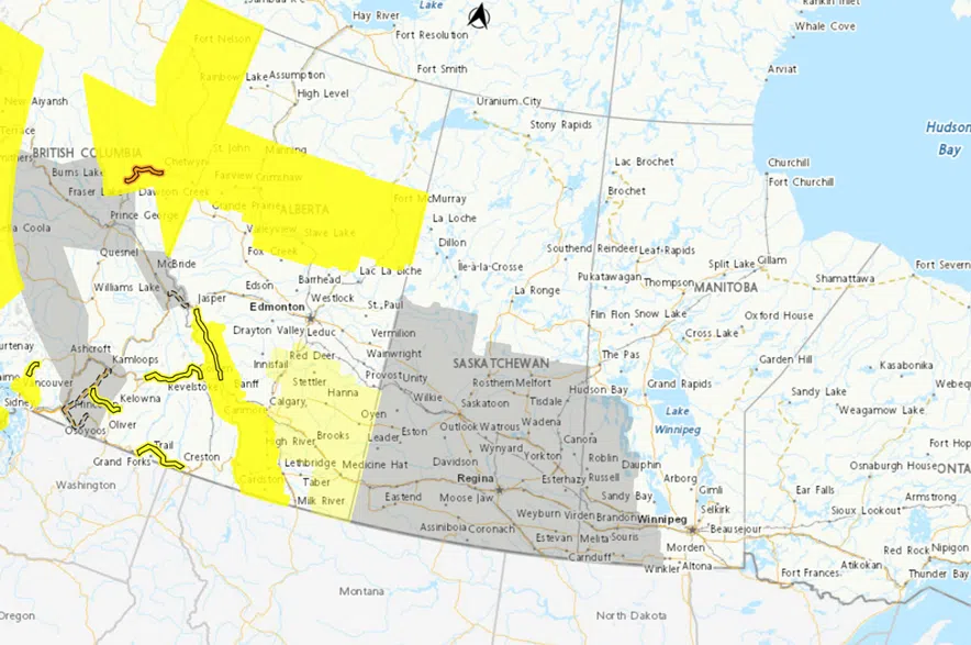
Large areas of Saskatchewan were covered by a special weather statement from Environment Canada on Monday morning, and meteorologist Keane Kokolsky says weather warnings could be issued in the days ahead. (Environment Canada)
Environment Canada has issued a special weather statement covering central and southern Saskatchewan, warning of the rapidly changing conditions expected over the coming days.
Meteorologist Keane Kokolsky said strong winds and a wintry mix of precipitation are expected to roll through Saskatchewan starting on Tuesday morning and running until Wednesday morning.
“The special weather statement is just to give you guys a heads up prior to any warnings that will be issued in the next 24 hours until we get a better handle on things,” said Kokolsky.
“If anything, you may see freezing rain warnings or snowfall warnings, or potentially blowing snow advisories on the Saskatchewan side, but we’re not exactly sure if we’re going to be moving into a winter storm warning.”
Kokolsky said there is a lot of uncertainty around how the system will track through Saskatchewan, but the picture is expected to become more clear on Monday.
“Right now, it looks like this low-pressure system will develop over southern Alberta, Monday night into Tuesday morning,” Kokolsky said. “It will track east, and it will deepen quite rapidly as well, so it’s going to become a stronger system as it tracks off to the southeast.”
Kokolsky said areas south of the band of freezing rain could see strong winds on Tuesday, but blowing snow probably won’t be a concern.
“The lack of new snowfall, as well as the freezing rain, is going to compact the snow that’s already there, and the warmer temperatures as well will aid in that compaction, so you might not have a lot of snow blowing around,” he said.
Meanwhile, Kokolsky said heavy snow is expected as the system tracks further east.
Around 10 to 20 centimetres of snow is expected to fall northeast of Regina in an area stretching from Humboldt to Yorkton, Kamsack, and Moosomin, and even more snow could fall over elevated terrain.
“There’s potential for some extreme cold warnings to be issued later this week, but again that’s a little too far out right now, so we will have to actually see what’s going to happen there,” the meteorologist explained.
The latest updates on the weather alert can be found on Environment Canada’s website. Current information on road conditions can be found on the Saskatchewan Highway Hotline.
–with files from 980 CJME’s Abby Zieverink