

Murray Wood: Who's hot... and who's not
Every Friday, Murray Wood takes a look back at the week's news and decides who's hot... and who's not.
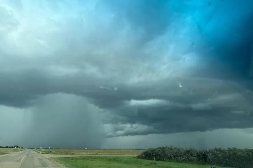
A thunderstorm that struck Swift Current on Saturday night left its mark, flooding parts of the city and knocking out power in some areas.
According to Environment and Climate Change Canada data, Swift Current recorded 41 millimetres or 1.6 inches of rain throughout the day, but the majority of it was recorded in one hour from 8 p.m. to 9 p.m. when 23.1 millimetres fell, with the storm producing 26.5 millimetres by midnight.
Read more:
The downpour prompted the City of Swift Current to issue a road safety advisory at 8:16 p.m.
Earlier in the day, another thunderstorm poured 14.1 millimetres between 1 to 5 a.m. in Swift Current.
Other storms also dumped torrential rain on Coronach, south west of Swift Current, the RM of Caron, southwest of Moose Jaw.
Last night we had a storm with a downpour like I’ve never seen before. The spillway pictured was bone dry.
Water in the ditches in areas was almost up to the highway, the round bales there almost submerged.
It was incredible.#skstorm #summer #weather #saskatchewan #sundayvibes pic.twitter.com/hjBrJ3kSjs— Todd McIntyre (@RanchHorsesSK) August 3, 2025
Caronport, Sk at 5:15pm. We couldn’t shake this storm. It kept hitting us over and over again. #skstorm pic.twitter.com/0ioRDPpNgj
— Jorden (@JordenRobes) August 3, 2025
Assiniboia received the second most precipitation in the southwest with 23.7 millimetres, ahead of Eastend’s 16.3 millimetres and Outlook’s 15.8 millimetres.
Lucky Lake’s weather station was the only other local one to collect double digits with 11.2 millimetres.
Cypress Hills received 6 millimetres and Val Marie collected 1.7 millimetres.
— by David Zammit, with files from CJME News
Read more:


")