

Sarah Mills: You never forget the memories of your first teacher
Teacher Appreciation Week has wrapped up in Saskatchewan, but Sarah Mills says the memories of the classroom, especially...
Saskatchewan’s February warm-up is expected to end soon, with snow and colder air forecast to return to much of the province tomorrow.
Environment Canada meteorologist Kyle McCauley said mild temperatures near 0 C had been “repeating” across much of the Prairies, but conditions are expected to shift as an Alberta clipper moves in.
Read more:
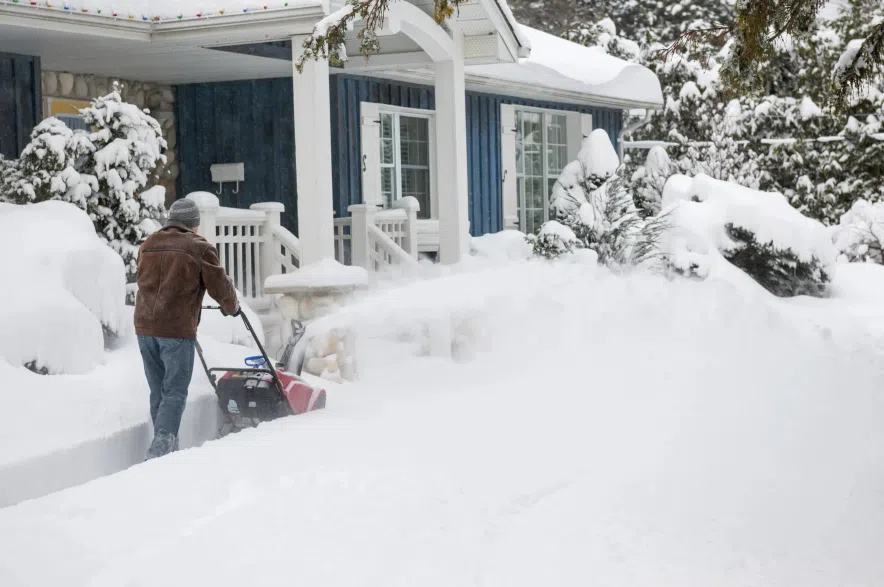
Environment Canada issued special weather statements for much of southern Saskatchewan on Monday — including the cities of Lloydmnster, Regina, Moose Jaw, Saskatoon and Prince Albert — saying people should expect 15 to 25 cm of snow beginning early Tuesday morning and tapering off late in the day Wednesday, with possibly reaching 30 to 40 cm locally from Meadow Lake southeastward towards Yorkton.
A number of snowfall warnings were also issued for west-central parts of the province, with the weather agency saying people in those areas should expect a “long period of snowfall” with total amounts of 15 to 25 cm beginning tonight.
Freezing rain will also be possible mainly near and south of the Trans-Canada Highway southward to the international border, Environment Canada said, adding that poor travel conditions should be expected on Tuesday and Wednesday
Once that system passes, McCauley said temperatures are expected to fall back closer to what’s typical for mid-February, “normal being in the range of like around -7 C highs,” with overnight lows “-19 or -20 C” in the days that followed.
Even with the cooler snap, he said he doesn’t foresee a plunge into extreme cold.
“It’s nothing like into the minus 30s, 40s,” McCauley said. “I don’t foresee any extreme cold warnings coming out … temperatures might get down to the low -20s in the next week or so after this front passes through.”
The shift comes after a February stretch that, in McCauley’s words, had run well above average. He said parts of southwest Saskatchewan had been especially mild, with temperatures climbing into double digits.
“We’re seeing temperatures of over 10 C today, like Leader, Maple Creek area,” he said on Sunday, calling it “pretty warm for this time of year.”
McCauley said one reason the warmth could build was the lack of snow cover in some areas. With bare ground showing, more energy could be absorbed at the surface, helping temperatures climb higher than they would over fresh snow.
“That really helps get those temperatures up even higher,” he said.
Looking back over the past month, McCauley said Regina’s recent stretch had been markedly milder than normal.
“Most of February has been significantly above average, somewhere between like seven to around 11 C, 12 C — give or take — above average,” he said, adding late January had been much colder before the pattern flipped.
And for anyone tempted to declare winter finished, McCauley pushed back.
“It definitely isn’t over,” he said, noting Saskatchewan could still see winter weather deep into the spring. “Could go into March, we see snow in April quite often, too.”
McCauley said the province was essentially heading back to a more typical February look, just without the worst-case deep-freeze conditions.
— with files by CJME News
Read more: