

Murray Wood: Who's hot... and who's not
Every Friday, Murray Wood takes a look at the week's news and decides who's hot... and who's not. This week's list inclu...
Emergency alerts sounded Wednesday evening as severe storms rolled through central Saskatchewan.
“Severe storms will continue to track across Saskatchewan and southern Manitoba overnight into Thursday morning–bringing the chance of large hail and heavy downpours,” said Environment Canada.
Shortly after 8 p.m. the weather agency issued a tornado warning for the Saskatoon area and for people to “take immediate cover” from large hail and flying debris.
One of the worst hit areas was the hamlet of Neuanlage, just south of Hauge.
Joe Waldner said he was tracking the storm all day through the Saskatchewan Severe Weather Tracker Facebook page, which he helps run, before he eventually came face to face with “the beast” of a storm.
“This is probably the largest storm that I’ve tracked in the 12-plus-years history of that tracker site,” he said.
Waldner was headed to the corner store when he saw the storm coming. He stopped to film the “big mothership” coming towards them. He also warned his community to prepare for it.
“There’s so many people saying the siding’s all gone on their homes and their RVs are all busted up. It’s just a big mess.”
Waldner said a lot of hail came down, but didn’t do any major damage to his house.
“It was probably a little bigger than pea size, but there was so much of it I thought my windows were going to get busted. Thankfully, they held on.”
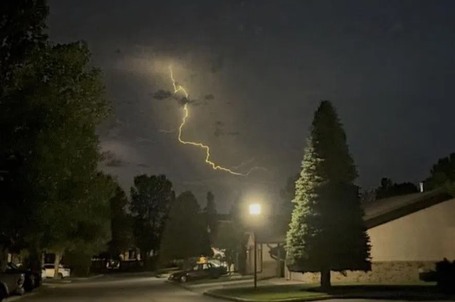
Social media lit up with video of intense lighting that flickered like fireworks across the Saskatoon night sky.
Alison Chevli submitted video of the storm’s tail end to 650 CKOM from Bergheim Estates on Highway 41, about 11 km northeast of Saskatoon, an area that received a tornado warning.
Mornè Lombard submitted video to 650 CKOM from the Warman area on Wednesday night.
650 CKOM’s Lara Fominoff watched the storm from the Brighton neighbourhood sharing a video of what appeared to be a funnel cloud in the distance.
The view from Brighton at around 8:30 pm. #skstorm @CKOMNews pic.twitter.com/W7cV5dSHLI
— Lara Fominoff (@LaraFominoff) August 21, 2025
Pea and loonie sized hail had people ducking for cover with some having to wait out the storm in their vehicles.
Scary storm just outside of Saskatoon tonight. Got some dents in the hood and a few cracks in the windshield. Then got a tornado alert. Some cars had windshields blown out. Pretty terrifying to experience. #skstorm @weathernetwork pic.twitter.com/FCJVITg91M
— Christine Thiessen 🇨🇦 (@ThiessenCLT) August 21, 2025
The storm kept Sask Power crews busy responding to outages in Eston, Kyle, Leader, Hepburn and Blaine Lake area.
The Dalmeny Police Service requested people stay indoors due to a downed tree and power line.
Meteorologist Keane Kokolsky said Wednesday’s storm was caused by a surface low that developed over the area, on top of a major low-pressure system to the northwest.
“It was like an upper trough that was beginning to move inland off the eastern Pacific coast there, which really led to what you guys were seeing yesterday in the Saskatoon area…. Some tornadic storms, large hail, and a ton of lightning, as well as some heavy rainfall, there.”
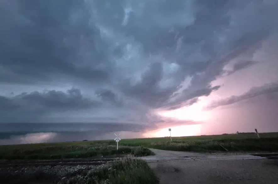
Storm clouds gather above Neuanlage, Aug. 20, 2025. (Joe Lockhart/Submitted)
Kokolsky said by 11 p.m. the tornado and hail threats started to diminish, but the lightning remained active.
While the tornado warnings stretched from Saskatoon to Humboldt, Environment Canada has yet to confirm if any actually touched down.
NOTE: What was the storm like where you are? Share your video and photos to webnews@rawlco.com